Main Beskidy Trail – longest mountain trail in Poland
Main Beskidy Trail – thru-hike of the longest trail in the Polish mountains.
When planning an expedition to a high-altitude peak, I always start by studying the terrain. I look at the shape of the mountain massif and its main summits – one of them will be my objective. Cols and ridgelines are logical routes towards the summit. The shape of glaciers, the locations of camps, and the gradients of slopes and ridges all determine the character and difficulty of the route.
How can you familiarise yourself with your route to a high-altitude summit before the expedition?
When researching a high mountain, I usually turn to several complementary sources. I’ll use Baruntse (7,152 m), which we climbed in autumn 2023, as an example.
I study it before setting off and always carry it with me on the expedition. A paper map always works and does not depend on any power source. A large map sheet gives you an overview of an entire mountain massif at a glance, whereas a phone screen shows only a small section. If I don’t mind marking it up (and usually I don’t), I can make notes and sketch the route directly on the paper map. I often take laminated maps on expeditions. They are durable and can last for several seasons. Lamination allows you to draw on them with dry-erase markers – a great way to show my participants where we are heading.
The maps of Nepal I used in the Baruntse region consisted of two sheets: “Makalu Base Camp” and “Everest Base Camp”. Both are available in many bookshops in Kathmandu.

A paper map at a good scale (e.g. 1:50,000) is very detailed, but it does not allow you to zoom in on a small section of the mountain. This is where digital maps come in handy. MAPY.CZ is an obvious choice: it covers the entire world and can be downloaded free of charge. I always keep an offline map of the region I’m visiting on my phone. For Baruntse, I needed a map of eastern Nepal.
The ability to zoom in helped us examine the summit ridge in detail. Thanks to the high level of magnification offered by digital maps, we were able to measure its length very accurately. The contour lines also showed us where to expect steeper sections.

On a computer, in online mode, mapy.cz also offers a 3D terrain view:

Sometimes, local mapping services covering a particular area are even better than mapy.cz. A great example is Toposvalbard, an exceptionally detailed map of the entire Svalbard archipelago.
Guidebooks covering Polish mountain ranges are easy to find. But what about high peaks visited by only a handful of people? They exist, too. Many mountain ranges, even those unknown to the average tourist, have dedicated guidebooks. Some are very specialised, but they can still be found. They are often buried deep in the depths of the internet or available in second-hand mountain bookshops and libraries. Sometimes you can find them in specialist climbing bookshops abroad. Occasionally, tracking down a rare publication requires contacting someone who owns a private mountain library.
In my case, the internet and Polish and international bookshops have always been enough. Patient searching online has allowed me to find guidebooks covering the Himalayan and Karakoram ranges, including digitised copies archived on the internet.
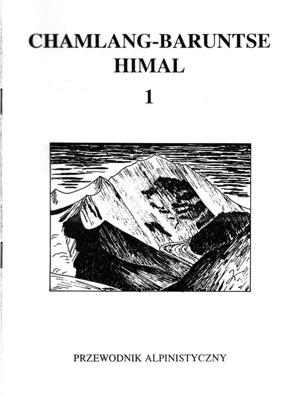
The area around Baruntse is described in a compact guidebook by Jan Kiełkowski, “Chamlang-Baruntse Himal”, Volume 1. It contains condensed information on routes and trails, previous expeditions, as well as numerous maps and drawings. Thanks to it, I knew the shape of the mountain and the difficulties of its ridge before I even flew to Nepal. Jan Kiełkowski’s guidebooks, although written 30 years ago, remain an invaluable source of knowledge.
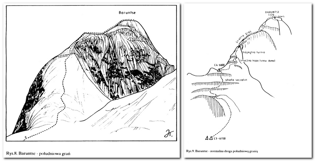
When preparing for my expedition to Gasherbrum II in Pakistan, I downloaded and printed Jan Kiełkowski’s guidebooks covering almost the entire Baltoro Muztagh region of the Karakoram. Only the eastern edge of the area was missing. To fill that gap, I bought his guidebook “Eastern Baltoro Muztagh”, which describes the Gasherbrum massif. Books from this distinctive series, with their red covers, describe all the world’s eight-thousanders. Despite their high price, they are worth buying if you are planning an expedition to an 8,000-metre peak. The description and sketch of the standard route on Gasherbrum II are exceptionally clear.
If you are looking for similar publications and maps, you can sometimes find them on various websites and file servers. They occasionally appear on Chomikuj.pl. A wealth of material on the mountains of Pakistan and Afghanistan is available at https://pahar.in/. Publications from around the world can be found in specialist bookshops such as the Polish second-hand bookshop “Filar” and Księgarnia Podróżnika, the Spanish “Librería Desnivel” and the British “Stanfords”. The Fram Museum bookshop offers an extensive selection of material on the Arctic. These are just a few places where you can order specialist literature without leaving home.
The PeakFinder app displays the peaks visible from any location in the world in a 360° panorama. Their names and elevations are shown alongside the mountains. Importantly, it works offline, as you can download the data to your phone. PeakFinder has a database of more than one million peaks – from Mount Everest in the Himalayas (8,850 m) to Kopa Cwila (118 m) in Warsaw. Its main purpose is to help you quickly identify the panorama from wherever you are. But the app offers much more: it includes a 3D model of every mountain. At Baruntse Base Camp, we could therefore virtually position ourselves at the foot of the massif and move along its ridge towards the summit. The model allowed us to examine the terrain and identify steep drops along the route to the top. We could view our mountain from above, from any angle and at any altitude – all from inside our base camp tent.

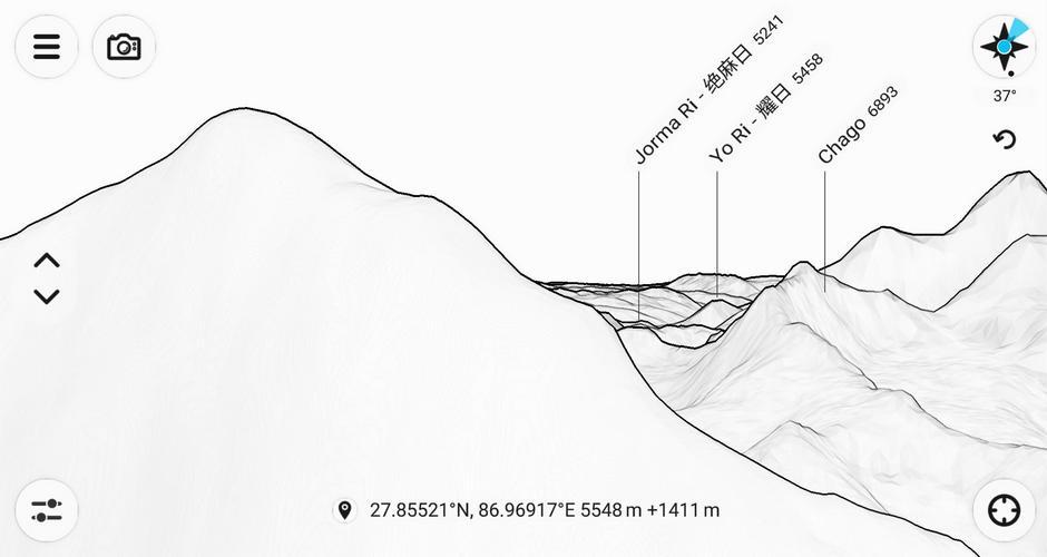
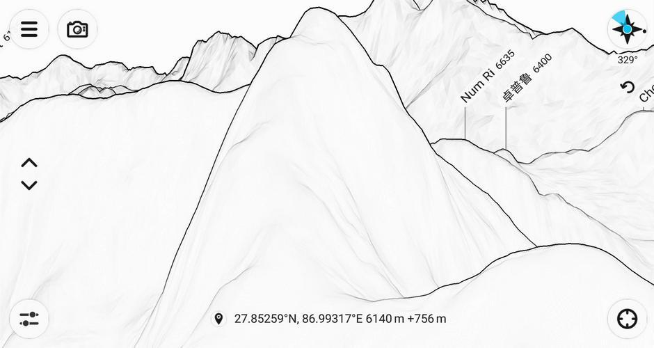
The strength of this kind of research lies in combining several sources. With a guidebook showing the mountain and a detailed sketch of its summit dome, together with the shape of the ridge displayed in the app, I was able to pinpoint every section of the route with great accuracy, almost as if I were looking at a photograph. I matched this picture with the brief description in the guidebook and knew exactly where to expect particular difficulties. All of this was possible without mobile reception, using data I had downloaded in advance.
When planning the Baruntse expedition, and later Gasherbrum II in Pakistan, I often turned to historical photographs. Climbers take plenty of pictures during their ascents, at base camp and in the higher camps. Photographs taken by people who climbed the mountain before you can help you visualise the route, assess camp locations, and judge the gradients and technical difficulties. The best photo collections can be found on Flickr and SummitPost. The latter deserves a closer look of its own.
This is a website about mountains around the world, built through contributions from climbers. It contains descriptions of peaks, expedition reports and photographs. The amount of information available depends on how popular a particular mountain is. In the case of Baruntse, I found a short but useful description of the summit ridge. The website also provides information on formalities and permits, transport arrangements, hiring porters, recommended mountain agencies and much more. Some of this information is outdated, so it is best treated with caution. The actual shape of a mountain route, however, rarely changes.
The website grew out of a database maintained by Elizabeth Hawley, a journalist based in Kathmandu, who devoted most of her life to documenting expeditions in the Nepalese Himalayas. Her archives were supplemented with information gathered from books, mountaineering magazines and correspondence with Himalayan climbers.
One of her first assignments was to report on the American expedition to Everest in 1963. This required her to interview the expedition leader and team members and collect detailed information about the climb. Hawley continued interviewing other expeditions travelling to Nepal. In this way, she created an enormous archive documenting their successes, failures, accidents and fatalities. After her death in 2018, her colleagues continued her work, making the archive available through this database.
The website looks old-fashioned, but it is easy to learn how to use. It contains information on thousands of Himalayan expeditions over the past 70 years. It is not 100% complete – for example, its records for Baruntse do not include the first Polish ascent in 2011.
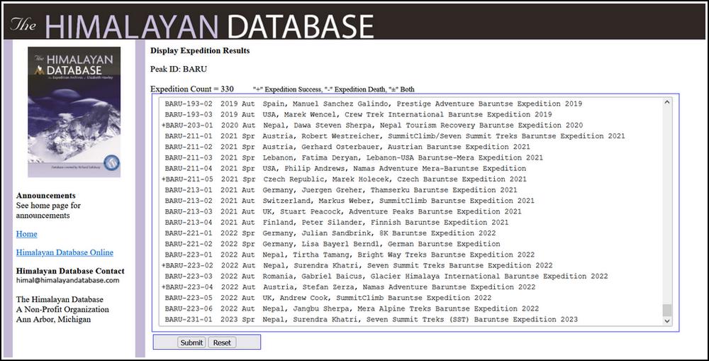
After selecting an expedition and clicking “SUBMIT”, you can access its detailed report:

None of these tools will provide all the information you need. Their real strength lies in combining them and cross-checking the information they provide. Finally, the value of first-hand information cannot be overstated. If you are planning to climb a high-altitude peak, look for people who took part in previous expeditions and ask them for advice. Very often, those who visited the region just a year or two earlier will be your best source of information.
If you use any other resources for planning high-altitude climbs that I haven’t mentioned here, I’d be happy to hear about them in the comments 🙂
Main Beskidy Trail – thru-hike of the longest trail in the Polish mountains.

First aid kit for mountains like the Himalayas, Pamir, or Andes. What does it contain?

My first aid kit for the mountains or travel